There are a few secrets when it comes to getting substantial warmth to built into our region heading into the first few days of winter, one of which we have been enjoying for days.
The lack of snowfall means we get to enjoy what little energy the sun is able to put out this time of year.
Our November blizzard dropped more than a foot of snow in several locations, followed by another storm system that went south of the area, and most recently another system that dropped snow to our northwest. In order to get some well-established cold, you'll typically need an expansive snowpack across our general region or somewhere close by.
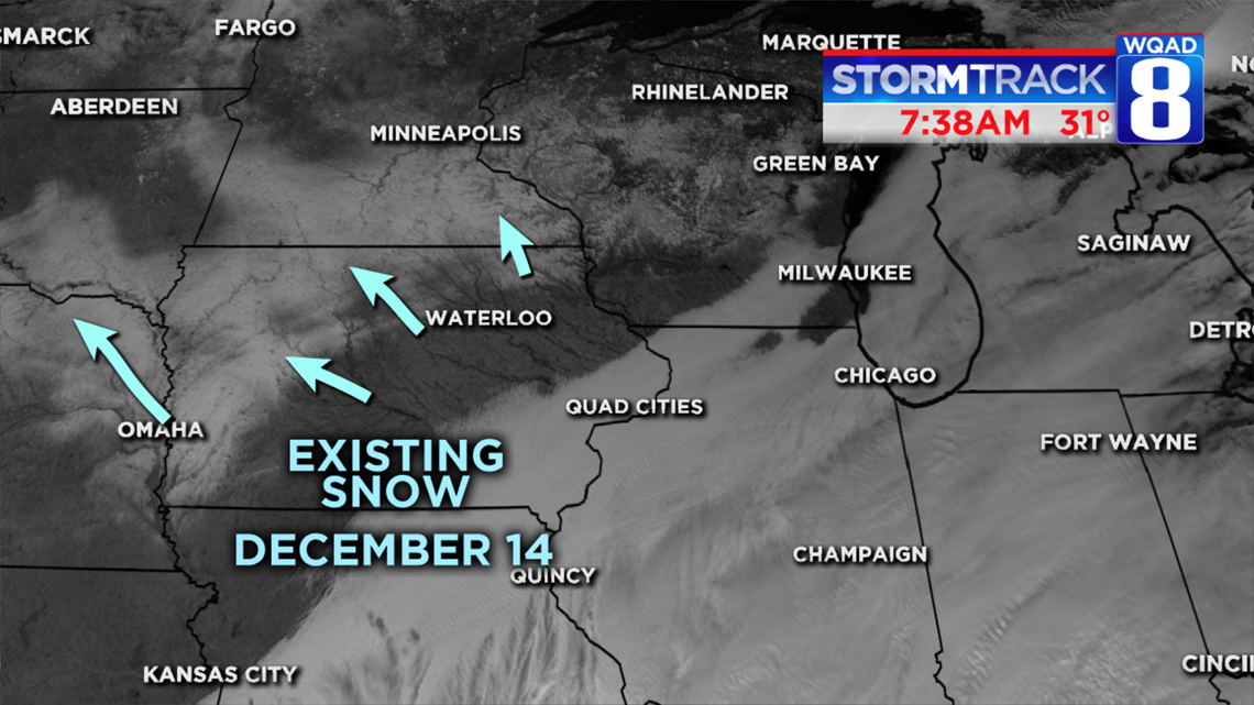

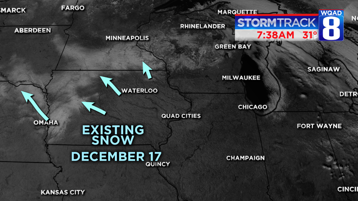
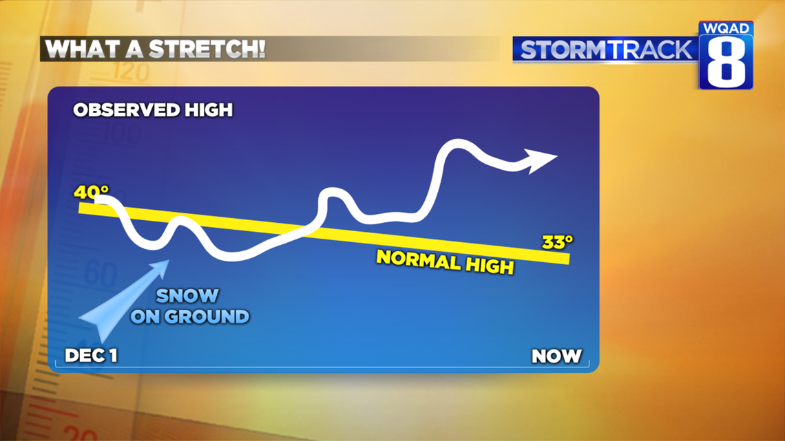
While the beginning of December still saw quite a bit of snowpack on the ground here locally, a gradual warming trend quickly began to eat it away resulting in the Quad Cities being relatively snow-free by December 10th. A more substantial snowpack existed over parts of northwest Iowa, but even that has been gradually eaten away as you can see in the above satellite image sequence.
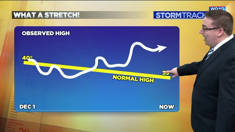
Going back to our high-temperature records for the month so far, you can see we averaged below-normal readings while some snowpack was still on the ground. Once it was gone temperatures have been soaring to above-average values and this trend looks to continue for at least another week, if not longer.

The month of December can often bring extremes when it comes to temperatures though. Remember two years ago? On this date, we had highs in the single digits and low temperatures in the double digits below zero!
Meteorologist Andrew Stutzke
Download the News 8 Weather App — for iOS, click here and for Android, click here
Download the free News 8 App — for iOS, click here and for Android, click here