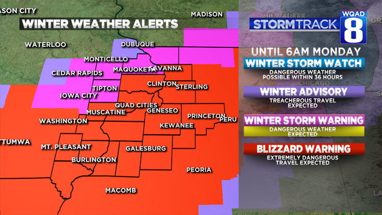
A BLIZZARD WARNING is now in effect until 6am Monday as areas of heavy snow and strong winds move in this evening.


A heavier band of snow mixed with sleet has already set up just north of the Quad Cities early this afternoon with another area of rain mixed with snow to the south. All precipitation will continue to change over to snow and intensify into the early evening hours. The heaviest snow band still appears it will set up between Mt. Pleasant, the Quad Cities, and Sterling/Rock Falls. This heavy band will be well established after 3/4pm this afternoon and last into much of the early evening hours. Visibility will be greatly reduced and roads will quickly become snow covered.

Generally, all locations will receive roughly 6-9 inches with isolated higher amounts, with the exception of areas to the northwest of the Quad Cities where the cutoff will be much sharper in terms of amounts.
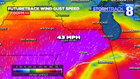
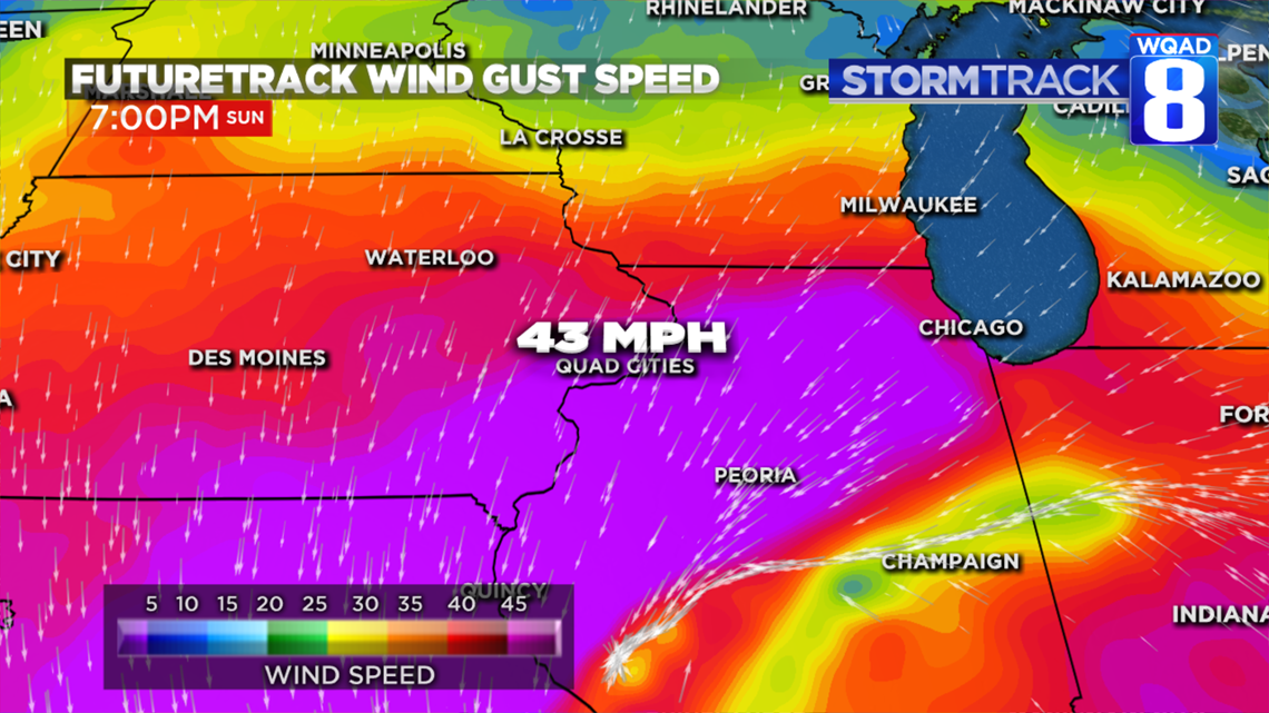
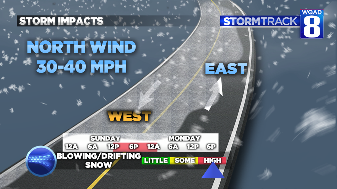
As winds increase through the late afternoon and evening blowing and drifting snow will become likely, especially in open areas. Winds out of the north will occasionally gust over 40 MPH at times making travel on east/west roads difficult and dangerous.
Try to avoid travel if at all possible this evening through the pre-dawn hours on Monday.