Temperatures finally reached above-normal for once making for a beautiful Thanksgiving Day. This warmth is going to hang on for a couple more days before we make a potentially dramatic return to winter.


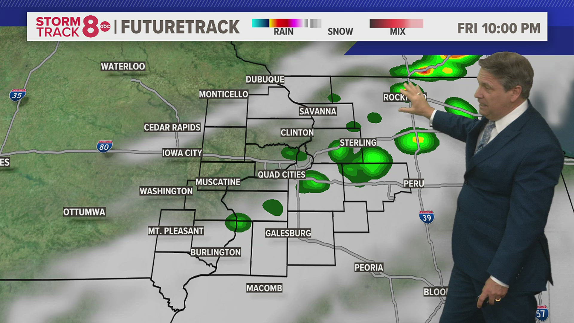
A warm front along with an area of low pressure will drive wet conditions after enjoying a dry and mild Friday morning. Areas of rain will begin to break out just before the noon hour, overspreading the entire area by mid-afternoon. Many areas will likely pick up around a quarter of an inch or less with this activity that will persist well into the evening. Winds will also be gusty at times from the south around 20 miles per hour with highs near 50 for Friday afternoon.
We’ll see a break on Saturday with partly sunny skies and another mild day likely. Highs will once again reach towards 50 by the afternoon. This will be the day to get outside and complete your holiday decorations as our chances for accumulating snow will be steadily rising heading into Sunday.


Most model data is still suggesting a very healthy winter storm somewhere in the Midwest by Sunday afternoon and evening. This will bring a round of rain mixed with snow before changing to all snow by Sunday evening. The image above shows the European model, which puts the Quad Cities in the heart of the snow by Sunday evening.


While models are starting to converge on an overall solution, even a track just 50 or so miles to the north of south can make a big difference. The European model keeps the heaviest snow potential right over the Quad Cities, while the GFS, or American model, pushes the storm system a little further south putting areas along and south of I-80 at risk for the heavier snowfall totals.
In the next 24 hours we will have increased confidence on where the heavier band of snow will layout. This area will likely see at least four inches of accumulation with localized higher amounts likely. Stay tuned!


One thing that is certain will be the fact that this storm will be quite the wind maker, meaning any locations that experience snow accumulation will also experience quite a bit of blowing and drifting snow, especially in open areas. The potential for ice or freezing rain looks quite low with this particular storm.
BOTTOM LINE: Travel will be significantly impacted throughout our entire region, especially by Sunday afternoon through early Monday morning. Avoid travel if you can and pay attention to later forecasts which will better define the locations where these impacts will be the greatest.