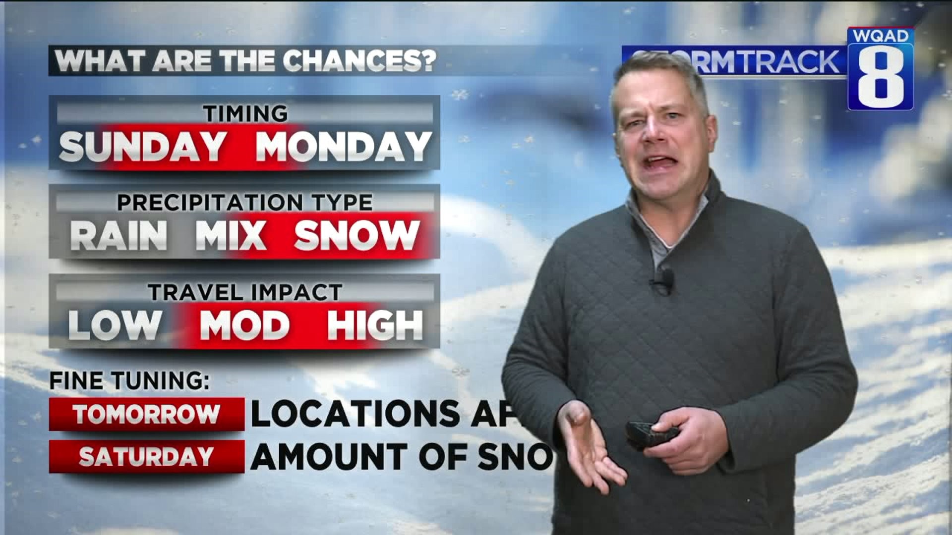
While we've seen a few minor accumulations of snow in the month of November, a more sizable system is on the way for Sunday.

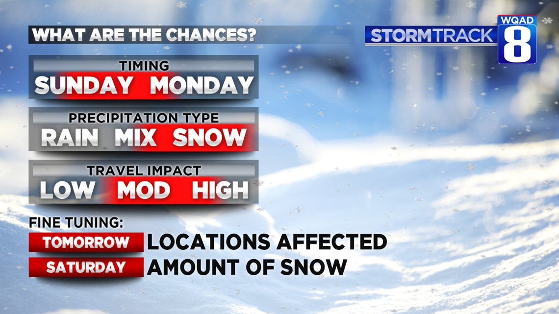
Winter Storm Watches could be issued as early as Friday morning in advance of this upcoming weather system. Low pressure will develop rapidly around St. Louis Sunday morning on a track toward Fort Wayne, Indiana. Avid weather watchers know this as a prime track for snowfall in Eastern Iowa and Northwestern Illinois. As it deepens, cold air will wrap into the system. That means that any rain falling in the beginning will change over to snow during the mid-morning hours of Sunday with some healthy accumulations by Sunday night.

One thing we are seeing in our models is very impressive consistency. Not only have we seen that day to day, but models are really honing in on that 4-8 inch possibility.
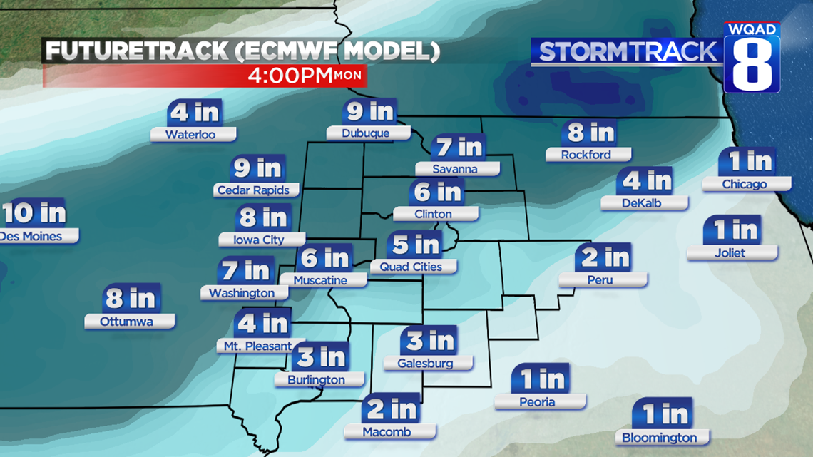
Please notice how these model solutions are NOT the same. That's why we can't give you the slam-dunk "here's what's going to happen" forecast. Instead, we have an idea what we're up against here four days out.
Still more time to track it. It could intensify, it could weaken, and it could veer in another direction. But if you're traveling or planning to travel on Sunday, you might want to think about that Plan-B.
Happy Thanksgiving! -Meteorologist Eric Sorensen