
The combination of high winds, warm temperatures, and dry fields will lead to an increased risk of wildfires today.
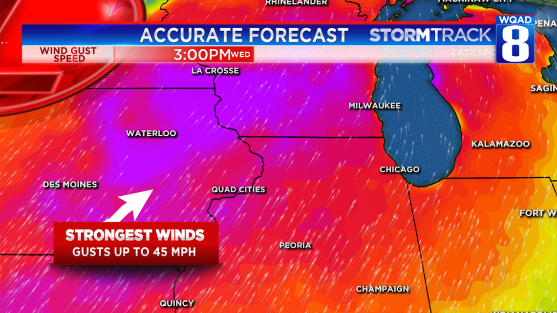
A new area of low pressure moving through parts of Iowa and Wisconsin today will battle with a strong area of high pressure to the southeast of the Quad Cities creating windy conditions by the middle of the afternoon. Winds will likely gust as high as 45 MPH at times, especially towards the evening hours. These winds will be coming from the south and will help push our temperatures well into the 80s which is very unusual for the month of October.
It only takes a few of these ingredients to produce an elevated risk for wildfires and today will be a good example of that.
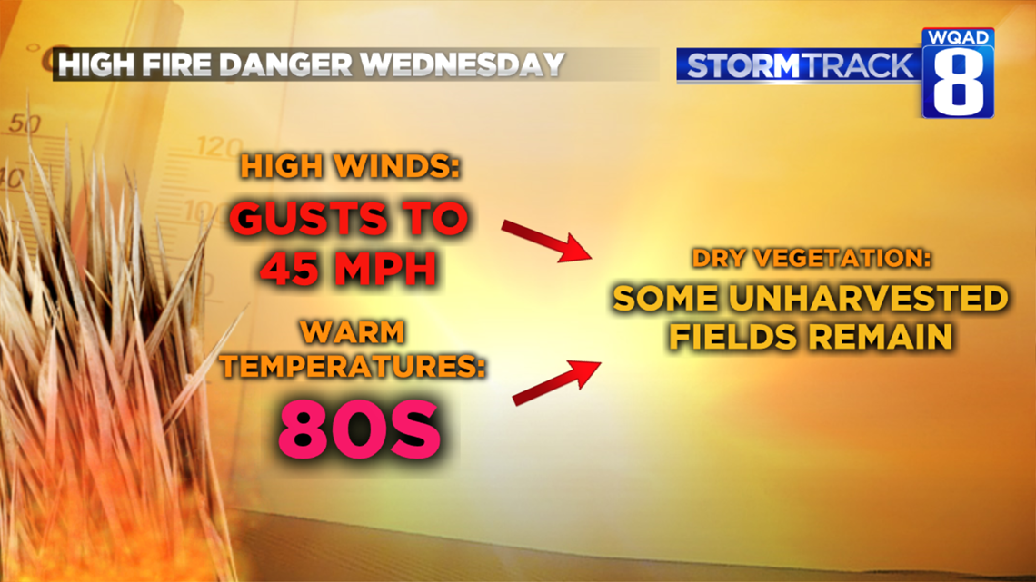
The combination of warmer temperatures and high winds along with fields that are in the process of drying out will combine to produce that elevated fire threat this afternoon and into the first part of the evening. Outdoor burning should be avoided today as fires can quickly spread out of control in these conditions.

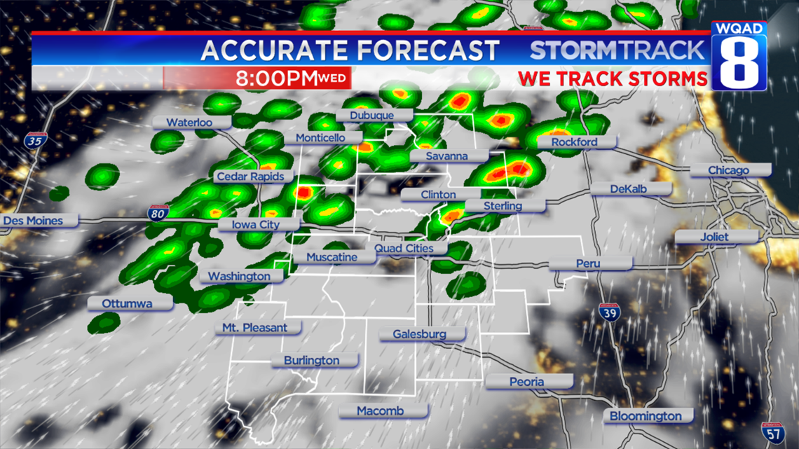
A cold front will sweep through later tonight switching winds to the northwest and bringing through a round of showers and thunderstorms. No severe weather is currently expected and the activity will remain scattered, especially after midnight.
Meteorologist Andrew Stutzke
Download the News 8 Weather App — for iOS, click here and for Android, click here
Download the free News 8 App — for iOS, click here and for Android, click here