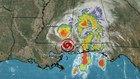
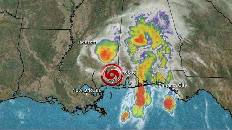
PEORIA (Illinois News Network) -- All of central and southern Illinois will see rain this weekend – and some places will see too much.
Illinois' flash flood watch stretches from just north of Peoria to the southern tip of the state.
The National Weather Service's Heather Stanley said central and southern Illinois will see anywhere between four and six inches of rain before the remnants of Tropical Storm Gordon dissipate sometime Sunday.
"The heaviest rains will be between I-72/I-74, essentially from Jacksonville over to Champaign and then north of I-64."
Stanley said some areas could see more than six inches of rain.
The National Weather Service is, as always, reminding people to stay out of flooded areas. Stanley said people should never drive through high water and should never wade into floodwaters unless they absolutely must.
"Don't drive through flooded roadways. It's just not worth it. You have no idea of the road conditions underneath," Stanley said. "When it comes to flood water, do not play in it. It is not a pool. When you have floods, that water is backing up from somewhere. So there is potential sewage in the water, there is potential bacteria in it."
Illinois' flash flood watch in effect for central and southern Illinois until early Sunday.
-WQAD contributed the video in this story.