
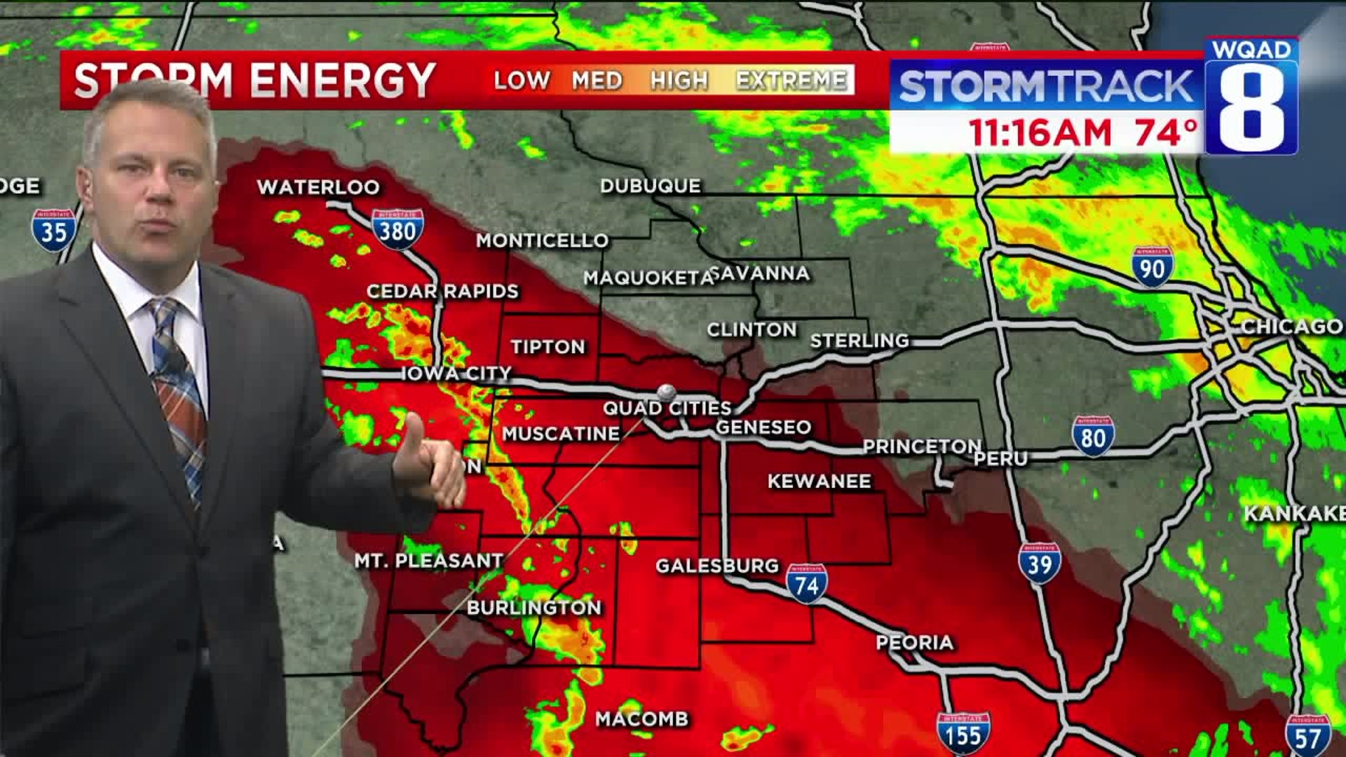
Late this morning, WQAD received a few reports of funnel clouds over Western Illinois. While radar did not detect any winds over 30 mph, some small funnels are possible.
Sharon Simpson just observed this small funnel near her home in Little York, Illinois, about 30 miles south of the Quad Cities:
Sharon Simpson just observed this small funnel near her home in Little York, Illinois, about 30 miles south of the Quad Cities.
Mature storms could produce funnel clouds into the afternoon, but this is not an environment that will produce significant severe weather. pic.twitter.com/aPVhrnAxi0
— EricSorensen (@ERICSORENSEN) June 21, 2018
Sharon tells WQAD News 8, "We watched it for quite awhile then it just went back up. Crazy!"
Jake Ewing near Seaton, Illinois captured this funnel less than an hour ago. @wqad pic.twitter.com/4JPc9OdEed
— EricSorensen (@ERICSORENSEN) June 21, 2018
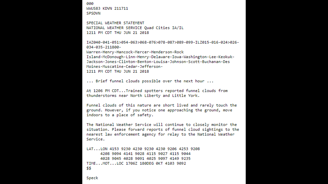
Within the past few minutes, the National Weather Service Quad Cities put out a special weather statement concerning possible funnel clouds into the afternoon.
A look at the rotation on radar when the funnel clouds were sighted an hour ago. #ilwx @wqad pic.twitter.com/57K6KWH1xD
— EricSorensen (@ERICSORENSEN) June 21, 2018
https://platform.twitter.com/widgets.js
Above is a look at the doppler velocity around the time of the sightings. There is noticable rotation just south of Seaton and west of Little York, but the wind speeds are only around 20-50 m.p.h. Even if the funnel made it to the ground, it's not likely that much damage would be done with speeds that low.
This is not an environment that will produce damaging tornadoes. However, if you see a funnel cloud and it appears to your south especially, seek shelter indoors, away from windows.
Flash flooding is also a threat into the afternoon, especially where storms persist over the same areas. 2-3 inches of rainfall will be enough to cause some roads to go under water, especially near poorly-drained culverts and creeks.
-Meteorologist Eric Sorensen