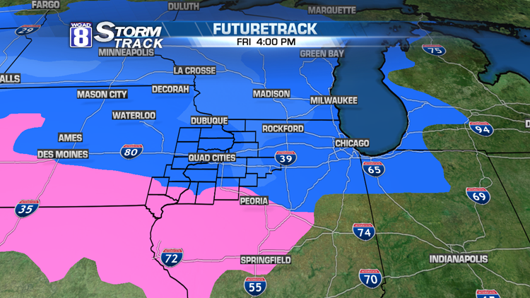
Saturday Update: While most areas have been spared any snowfall today, snow will develop as we go through the afternoon and evening. 1-3 inches of snow is possible this evening with gusty wind. Since temperatures are much colder than 32 degrees, this will be a fluffy snow. That makes it easier for the wind to blow this around. Winter Weather Advisories are in place due to blowing and drifting snow, especially on rural roadways. Be careful!
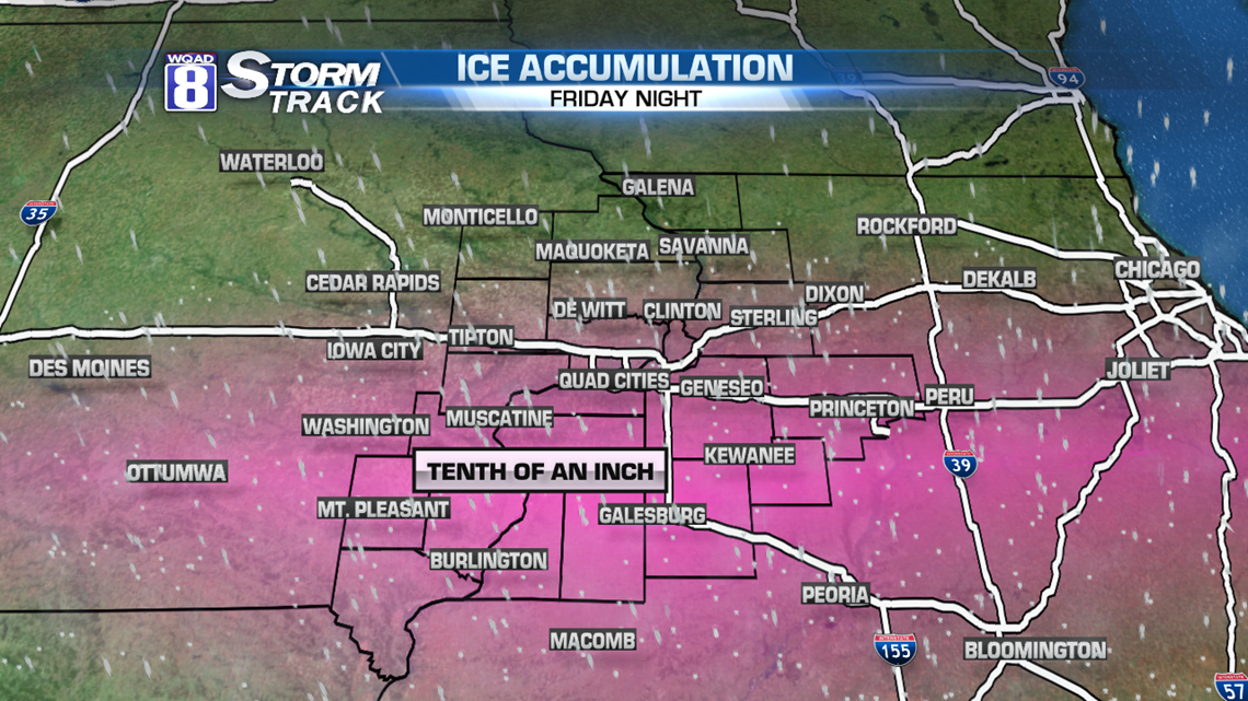
Friday Original Post: Winter Weather Advisories will go into effect today at noon, lasting through early Sunday morning. An inch or two of accumulation of snow is possible as we go into the late afternoon and evening hours. After 10pm tonight, some freezing rain will mix in with the snow causing a glaze of ice up to 1/10 of an inch. Greatest risk for ice will be along and south of Interstate 80. 1/10" of an inch doesn't sound like much, but that’s just enough to make things very slippery…especially through the overnight hours.
We’ll see a break in the action for much of the day Saturday. That should allow road crews to clean up from the icy-snow from the night before. But more snow is anticipated for Saturday afternoon and evening. This will be a fluffy, fine snow and could accumulate 1-3 inches. So totals for this system will be 2-5 inches across our area with little/no accumulation south of US Highway 34 and more than 5 inches along and north of US Highway 20. By Saturday evening, the wind will be howling out of the northwest, possibly on the order of 20-30 mph! Not only will this cause wind chills to plummet, many rural roads will become wind-blown and snow-covered again. It’s quite possible that the worst driving conditions will be after the snow is done Saturday evening and night.
Sunday will be dangerously cold. We’ll start at -10 with high temperatures around -1 in the afternoon. Wind chills will easily touch or exceed -25. Wind Chill Advisories or Warnings are expected once the snow ends Saturday night.
-Meteorologist Eric Sorensen