Good morning, friends!
A powerful and potentially catastrophic hurricane will come ashore (or close to it) along the Florida Coast by tonight. Hurricane Warnings have prompted an evacuation of close to two million people with residents bracing for damage and power outages that could last for a week or more.
Here’s the Meteorology behind the storm this morning. (NOTE: Some images may take extra time to load, due to file size.)

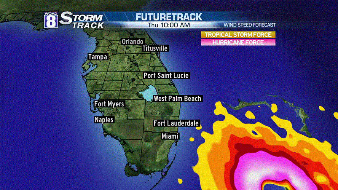
Above is the Futuretrack/RPM solution for wind speed. Areas in orange are tropical storm force (39-73mph) with areas in red to pink over 74 mph. Where the colors go white and then eventually to no-color, that’s where winds will exceed 100 mph…dangerous stuff!

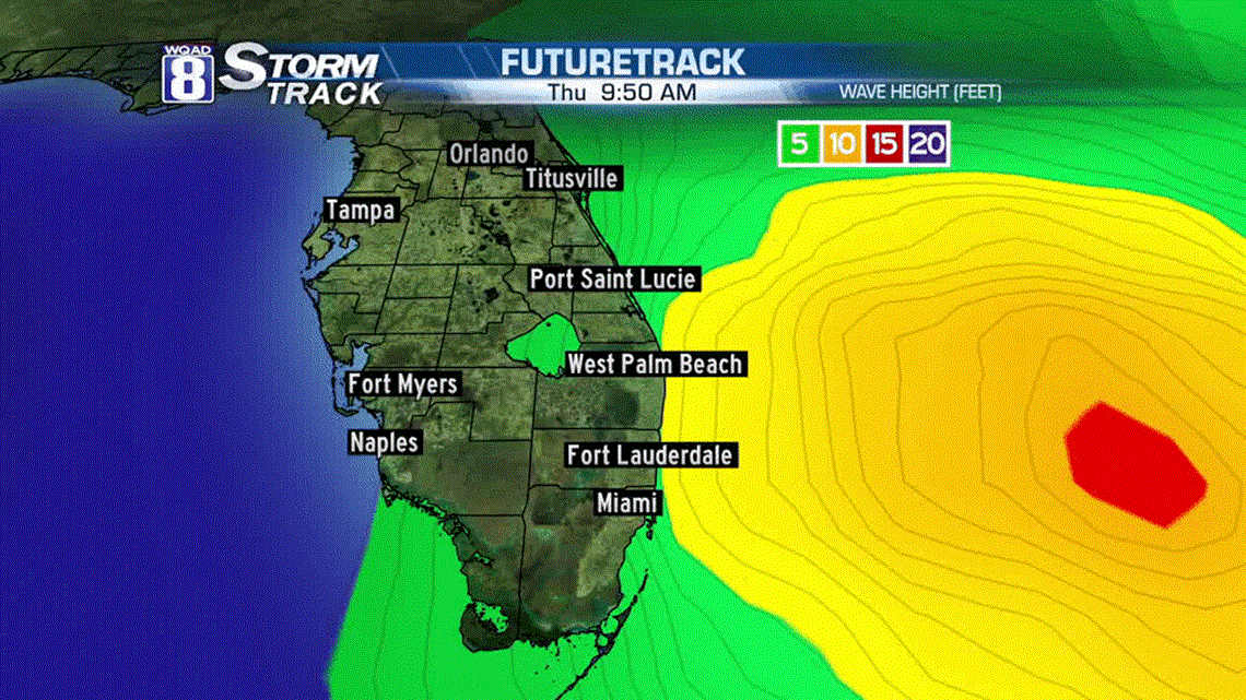
In addition to extreme wind, there will the problem of storm surge. Above is the wave-height forecast. Keep in mind, this isn’t necessarily what the surge will be. Instead, the model is showing where the waves will be produced due to wind. According to the National Hurricane Center, the highest storm surge is expected north of West Palm Beach, all the way to Jacksonville. The surge could be on the order of 10 feet which would encompass the first-floor level of homes and businesses! And that’s a big distance…almost 300 miles of potential storm surge. 300 miles of possible extreme damage.

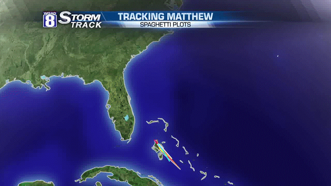
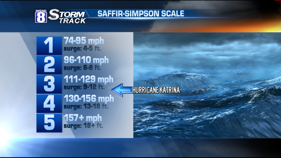
Now let’s get into the potential track for a possible landfall. According to the official definition from the National Hurricane Center, a landfall is when the center of the circulation comes onto land. Since this will be tracking almost on the beach, it’s impossible to say this is going to come into Florida or whether it will remain over the open water. However, as the eyewall of hurricanes comes into contact with a coast, it’s more likely that the friction from land will cause it to wobble onto land. That would be bad news for the area north of Fort Lauderdale up to Cape Canaveral. Intense, right-front quadrant wind of 125 mph+ would be likely, causing massive devastation. Again, the best chance for that to take place would be along the Space Coast. This is forecast to be a category-4 hurricane on the Saffir Simpson Scale, bigger in strength than Hurricane Katrina. However, since Katrina came in at a 90 degree angle, it was able to put the right front quadrant right onto Biloxi, Mississippi. It remains to be seen whether this storm, with its current trajectory, will be able to produce that amount of damage.

Aside from the damage and destruction possible to homes and property, according to a government summary of Kennedy Space Center’s hurricane plan. Winds of Matthew’s magnitude could pose a threat to some of the historic structures at the space center. The Orbiter Processing Facilities are rated to withstand winds of 105 mph, while the iconic Vertical Assembly Building, Launch Control Center, launch pads, and other facilities can withstand 125mph winds. Newer facilities built after Hurricane Andrew, in 1992, were designed to withstand winds of 130mph or greater.

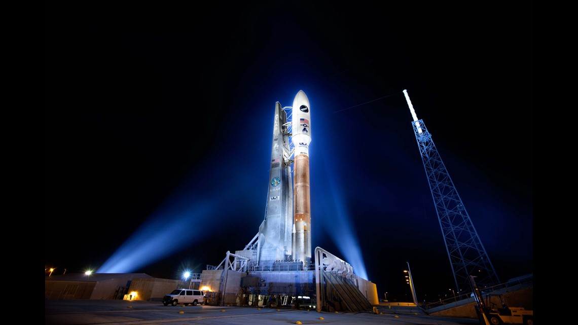
Above is the “before picture” of the Atlas-5 rocket that will launch NOAA’s “Goes-R” satellite. It is scheduled to launch in the first few weeks of November…sitting on a rocket on the launch pad right now. The Goes-R satellite is intended to provide better resolution to clouds. In turn, that data goes into models which will provide better hurricane forecasts.
Talk about irony!
It’s my hope that Floridians have heeded the advice of local officials and Meteorologists. Evacuation orders need to be completed by midday today. Being on the roads after that will be very dangerous.
Here’s a live video that I did early this morning. Godspeed, Florida!
-Meteorologist Eric Sorensen