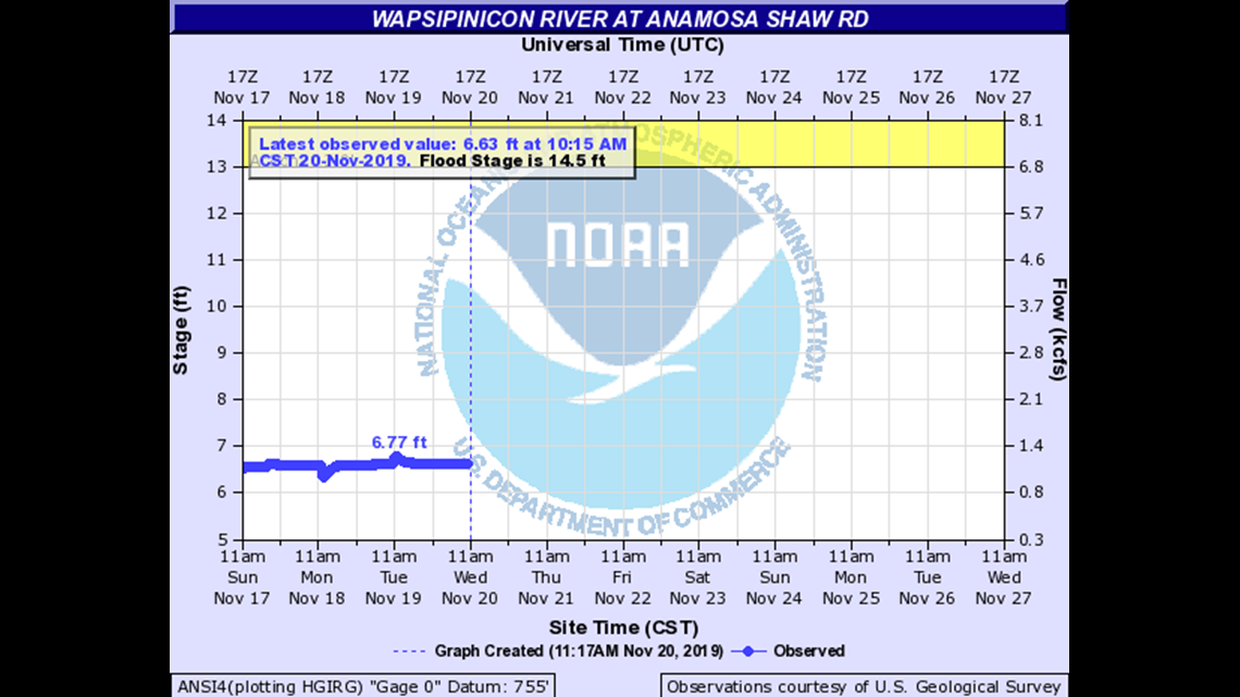
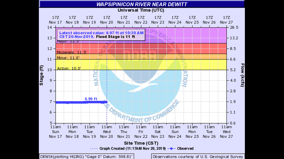
We are keeping an eye on rising river levels this week. Because many of our waterways will reach or exceed major flood stage, we want to make sure you find all of the river forecast information you’re looking for. Below, the forecast crest graphs from the National Weather Service and the impact that level of flooding will have on surrounding areas.
Click here for other rivers: Mississippi River | Cedar River | Iowa River

| 26 | County Roads X64 and X75 are closed. |
| 22.9 | Fairview Highway at the Wapsi Bridge is closed. |
| 22.5 | Water reaches Shaw Road pavement. |
| 21.6 | County Road X64 between Oxford Junction and Oxford Mills is closed. |
| 21.5 | Major Flood Stage. Stone City Road is closed. |
| 18.8 | Landis Road is closed. |
| 18.5 | Water is at the bottom of the Shaw Road bridge. |

| 15.5 | Water reaches the bottom of the County Road Z30 bridge deck. Water reaches the bottom of the Iowa Highway 956 bridge deck. |
| 15 | Water reaches the bottom of the U.S. Highway 30 bridge deck and affects the lowest sections of U.S. Highway 30 between Wheatland and Calamus. |
| 14.5 | Water affects U.S. Highway 67 near Folletts and affects the lowest sections of County Road Z30 near McCausland. Water also affects the lowest sections of County Road Y52 near the river and affects access roads to Buena Vista. |
| 14 | Water reaches the bottoms of the U.S. Highway 67 bridge decks over the Wapsipinicon backwaters. Water also overtops the floodwall to an establishment near the old U.S. Highway 61 bridge. |
| 13 | Water affects many residences along the river. |
| 12.5 | Major Flood Stage. Water affects old U.S. Highway 61 near the river. |