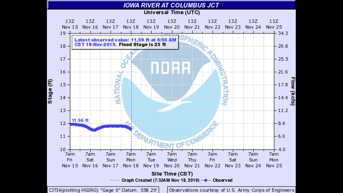
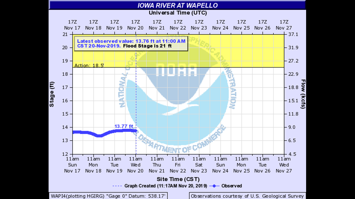
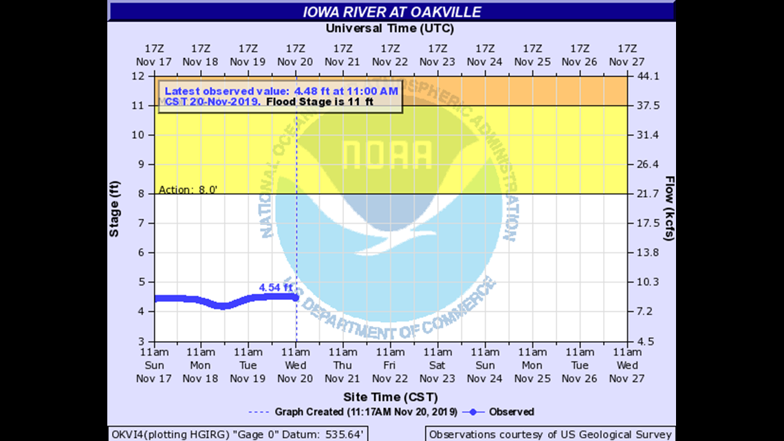
Because many of our waterways will reach or exceed major flood stage, we want to make sure you find all of the river forecast information you’re looking for. Below, the forecast crest graphs from the National Weather Service and the impact that level of flooding will have on surrounding areas.
The Iowa River takes in all of the water from the Cedar River. For that reason, no flooding is expected upriver of the confluence of these two rivers. A Flood Warning is in effect for the following areas.
Click here for other rivers: Mississippi River | Cedar River | Wapsipinicon River

| 31.31 | Water is at the lowest portion of the west abutment on the IA Hwy 92 bridge. |
| 31.01 | Water is at the lowest portion of the east abutment of the IA Hwy 92 bridge. |
| 31 | Water is on the west approach to the Iowa Highway 92 bridge. |
| 23 | Water affects residential property along the river south of the Iowa Highway 92 bridge. |

| 32 | Water affects unprotected areas of Wapello. |
| 27.5 | Water affects U.S. Highway 61 north of Wapello. |
| 27 | Water reaches the bottom of Iowa Highway 99 bridge near Oakville. |
| 26 | Water affects the south approach to the Iowa Highway 99 bridge near Oakville. |
| 22 | Water affects residences near the U.S. Highway 61 bridge. |

| 19 | Water nears the top of the levee in Oakville. |
| 15.2 | Water affects the south approach to the Iowa Highway 99 bridge near Oakville. |