
We're waking up to bare ground in most of the area this morning. That's quite a difference from the 6-10 inches of snow that was forecast for the US-20 corridor from Dubuque to Rockford. Even Monday on GMQC, I forecast a few inches for the Quad Cities and we're waking up to none.
It's important to look at why forecasts don't work out the way we think they will. So what gives? A few things of note. Temperatures were much warmer than anticipated yesterday. We surged into the middle 60s instead of our forecast high of 56! So, that may be the first clue why ALL of our weather models got it wrong. Being ten degrees above normal at the onset of a winter event will really change the way the dominoes fall. But we did get some rain and freezing rain in the Quad Cities and there are still some slick spots.


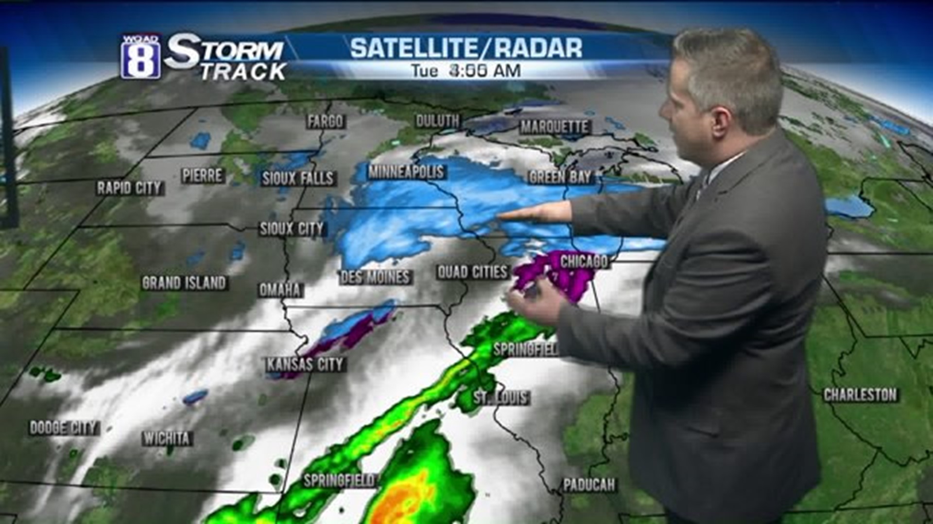
Further north, in the area where there was a Winter Storm Warning issued, the models just behaved poorly. Instead of having a stripe of heavy snow from Cedar Rapids to Rockford, the real heavy snow fell from Mason City to Milwaukee where folks are waking up to 3-6 inches.


Take a look at what it looks like outside of Mankato, Minnesota at KEYC-TV. My good friend Mitch Keegan, who's a Meteorologist and Quad-City native said "I think we took your snow. All signs pointed to 0.0" for us yesterday." Indeed, Mitch. This REALLY shifted north. In fact, it's the biggest shift I've seen in a winter storm all season!
Now back to the error factor. Chief Meteorologist James Zahara's forecast at 10pm last night had only an inch for the Quad Cities. We really never forecast much for the metro to begin with. Still not too pleased with how my forecast worked out for areas north of US-30 though.
Our next wintry system is on tap for Wednesday night into Thursday. You'll want to check back with us tomorrow for updates on that. And keep in mind that forecasting is fluid. We forecast, fine-tune, forecast, and fine-tune. If you just get one forecast and take it to the bank, get ready for surprises. Check back frequently and you'll be much better prepared for the best and worst weather!
-Meteorologist Eric Sorensen