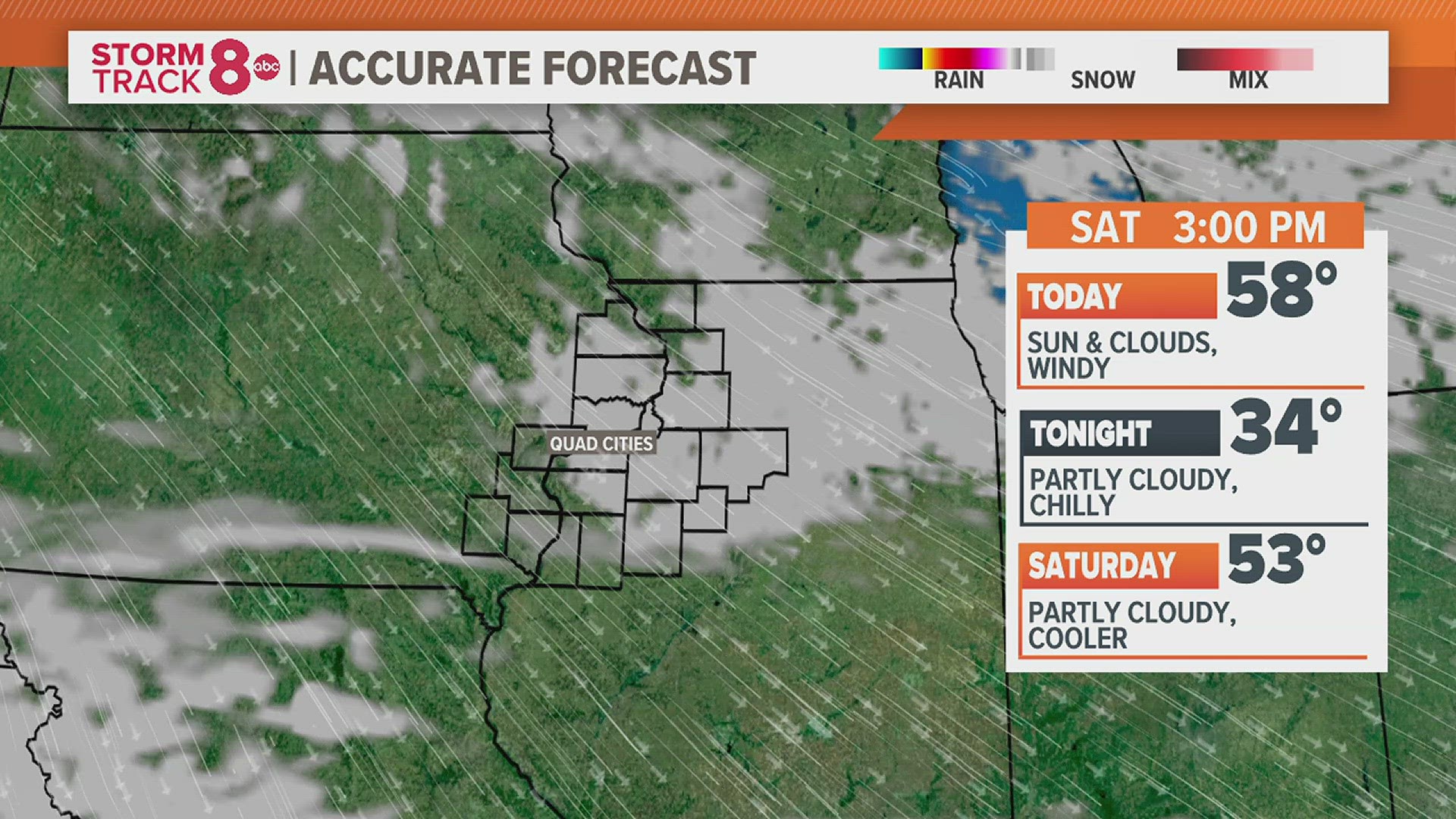
A few roads along the Rock River were closed because of flooding caused by ice jams.
Flood warnings were issued the week of January 18 after ice jams caused sudden, rapid rises in the river levels near Green Valley Sports complex and further downstream in Moline. The flood warnings were forecast to remain in effect until at least Tuesday, January 26; as of Monday, the National Weather Service said the warnings were in effect for the Rock River at Moline until further notice.
Flood stage for the Rock River at Moline is 12 feet. The river was at 13.4 feet in Moline as of Monday morning, January 25.
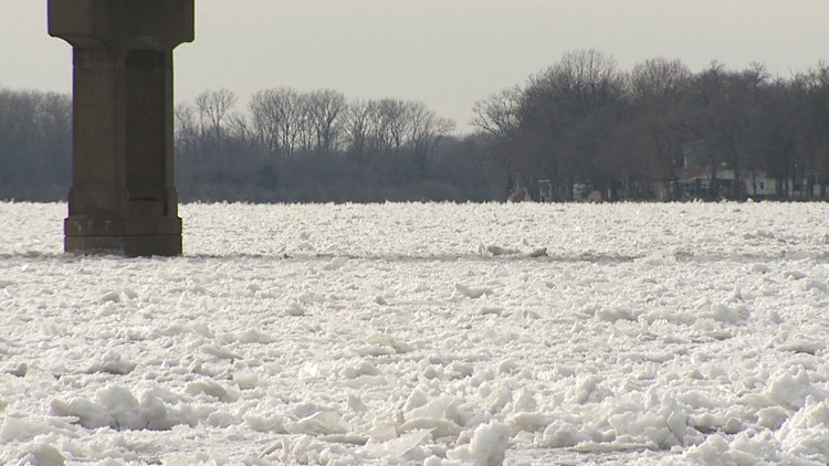
“The river has bank to bank ice from the mouth of the river to upstream of the Interstate 80 bridge,” said a warning post from the National Weather Service.
The water was expected to begin receding Tuesday, according to Rock Island County Sheriff’s Office Operations Commander Capt. Ron Erickson. In Moline, authorities closed portions of South Shore Drive, portions of North Shore Drive, the south end of 60th Street. Barstow Road was also closed near Interstate 80.
Tuesday morning, the NWS updated the flood warning as the river level was at 13.6 feet and steady.
“At 13.2 feet, water affects 60th Street south of John Deere Road in Moline, and 75th from Green Valley Park to the Nature Preserve. Water is also on Canal Road in Big Island,” the update said.
“Motorists should never try to drive through flood waters, as there are many hidden hazards lying underneath that are not visible,” Capt. Erickson said.