We are now headed into our second January thaw. Temperatures will go above freezing beginning at 10 o'clock today and last into the evening hours. A few hometowns (where snow has melted) could see temperatures rise into the upper 40s to near 50 degrees!
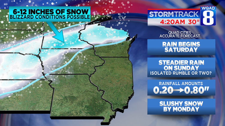
More mild weather is anticipated tonight into tomorrow as well when temperatures will rise into the 40s once again. There will be one difference though. Clouds will thicken up as we go through our Saturday with a few showers possible by dinnertime. Rain will be present in our forecast through Sunday when temperatures will surge up to 50 degrees in the Quad Cities. As low pressure scoots right overhead, some rumbly rain is also possible.
On the other side of Iowa, Winter Storm Watches are in effect. For the area of Northwestern Iowa, near the Sioux City area, as much as a foot of snow is possible. Some blizzard conditions could be possible as well! If you're traveling west of Des Moines late in the weekend, be ready for dangerous weather conditions.
Colder temperatures will move in after a cold front comes through Sunday night. If there's enough moisture still present, some of the light showers could switch over to some light snow on Monday. Little to no accumulation is foreseen at this time.
-Meteorologist Eric Sorensen