It’s not too often that severe storms come together in early December. But history has shown that late-season storm systems can produce wild weather. Iowa and Illinois have seen tornadoes and severe weather in every month of the year. While not a sure-bet for severe today, there’s definitely reason enough to be on guard this afternoon and evening.
NOTE: This is by far a sure-thing. Instead, clouds will likely limit the instability needed for strong storms. However, should we hold off on any afternoon rainfall and especially if we get some sunshine (to heat up the lower atmosphere), we could really rile things up.

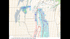
Above is a simulated radar product from our Futuretrack computer model. Below, a little more about the dynamics in play for later today:
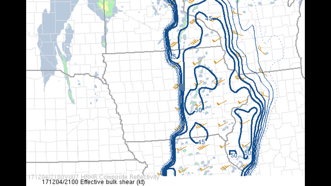
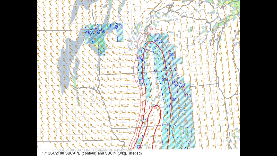
But wind shear isn’t the only thing we need to pay attention to. The above map shows CAPE, which stands for “convective available potential energy.” CAPE is a good level of how much gas is in the tank, so to speak. A nose of 1000 CAPE is a good indicator of instability nudging its way north from Missouri. Again, this is something that also points to an increasing chance for severe weather.
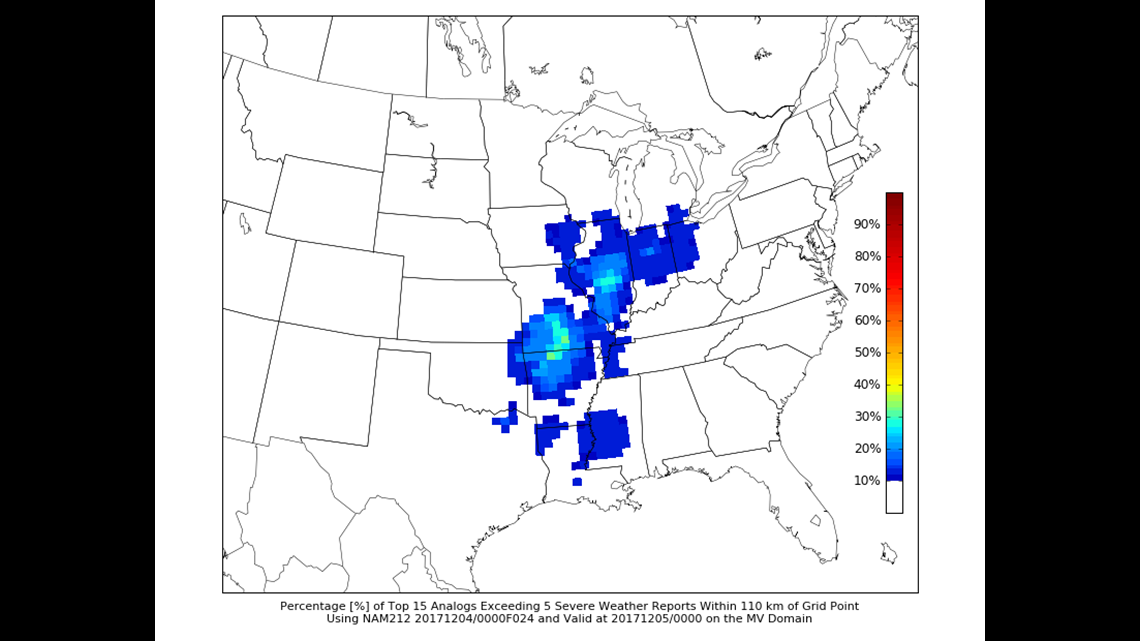
One thing that we like to ask ourselves in situations like these is, “Has this happened before? What are the chances?” About five years ago, St. Louis University developed a database and interface that allows us to look at the 15 most similar weather systems to what we have today. It helps us answer the question, “Has this happened before?” And according to that, the answer is “Yes.”
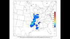

First, let’s look at the chance of any severe weather at all. The map above shows the percentage chance of one severe weather report. And with these maps, don’t focus on the sharp cut-off from 30% probability to 0% right over the Quad Cities. The edges of this map really could be blended to indicate a chance for severe storms, mainly south of the Illinois-Wisconsin border.
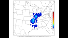
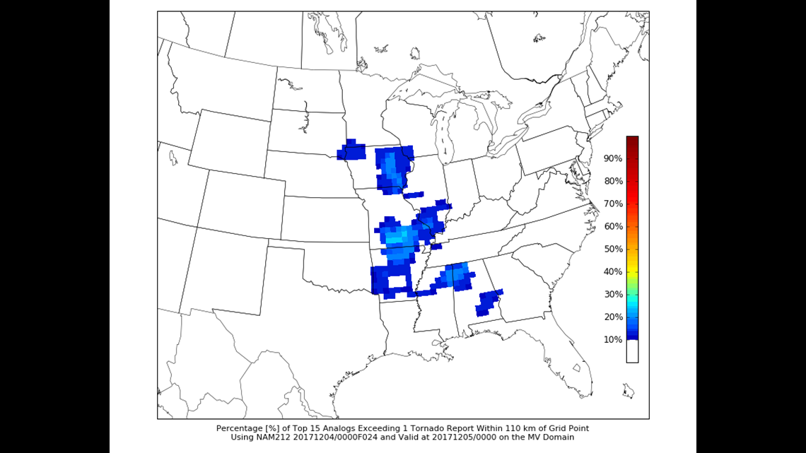
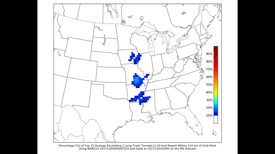
Lastly, here’s the chance of seeing a long-track tornado. A long-track tornado is a very, very rare event. In fact, according to U.S. Tornadoes, a twister research group, only 2.5% of all tornadoes achieve long-track status, traveling 25 miles on the ground. Around here, the EF-4 Fairdale, Illinois tornado of 2015 is the most recent in memory. Is that going to be repeated? Someday.
Today’s not likely, but the chance is not zero today. Make sure you have a way to receive weather warnings today.
-Meteorologist Eric Sorensen