Officially, Spring doesn’t begin until March 20th. And typically, March brings 4.0 inches of snow to the Quad City region. Even though it’s been unseasonably warm with numerous record highs, our chance of snow isn’t over it seems.
Beginning this weekend, a series of storm systems will move in from the Pacific Coast. The first will affect our area on Saturday with a possibility of light snow. In the image below, you can see my initial thoughts on snowfall potential. Saturday’s on the right. Monday’s on the left.
The current forecast strength of the system doesn’t look like anything that will bury us. Instead, someone has the opportunity to receive an inch or two. And right now it appears the best chance will be south of the Quad Cities on Saturday.
The next system has a slightly better chance of giving us accumulating snowfall I believe.
Here’s a look at the GFS which shows snow on the ground from Canada, all the way down to Arkansas.
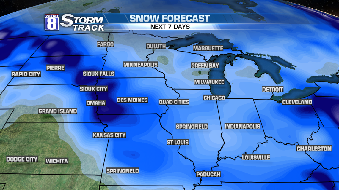
You may notice that I left out a very important feature. How much snow corresponds to the different colors of blue? I did that on purpose! Models will change intensity with every mathematical run. In fact, last night’s model showed heavier snow over Des Moines and now it’s placed out to Omaha. Point being, it will change.

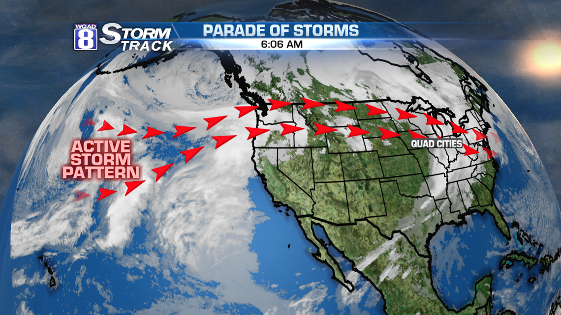
The big reason is the fact that Saturday’s (and Monday’s) area of low pressure is still way out in the Pacific Ocean! It’s not going to be on land until at least tomorrow. By then, we’ll have a better idea what will happen for the weekend.
I’ll post additional thoughts tomorrow and Friday. For now, some advice not to get used to the warm 50 degree temperatures today!
-Meteorologist Eric Sorensen