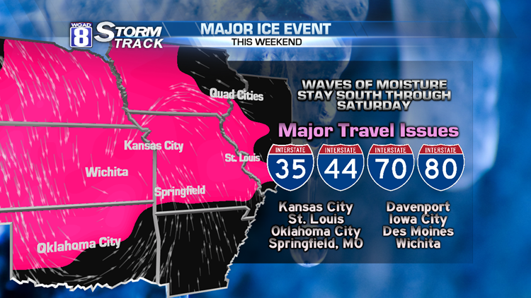
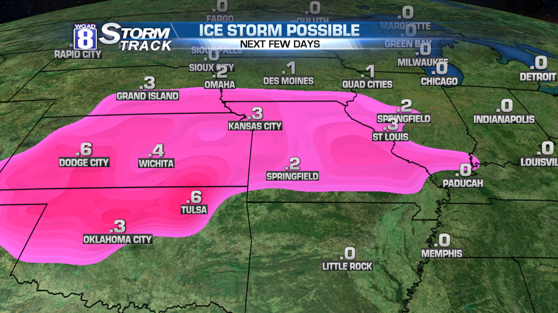
The chance of an ice storm is expanding across the Upper Midwest. Today, the threat exists in the Southern Plains, but through the weekend, that moisture will work north toward Iowa and Western Illinois.

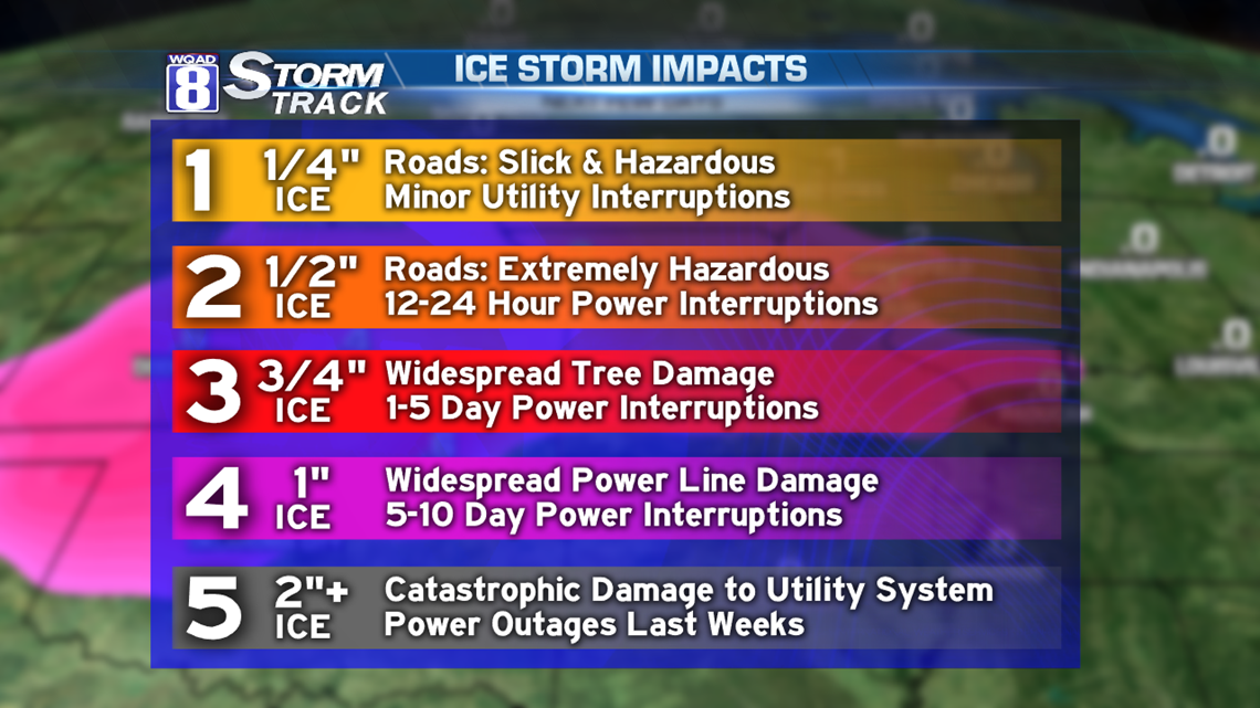
All eyes on a surge of moisture coming in from the south, increasing our chance of seeing icy weather this weekend. A potent ice storm has already begun Friday morning from St. Louis to Oklahoma City. Some parts of Oklahoma could see more than 3/4 inch of ice, which is expected to bring down trees and power lines. And that moisture will move north through the coming days.

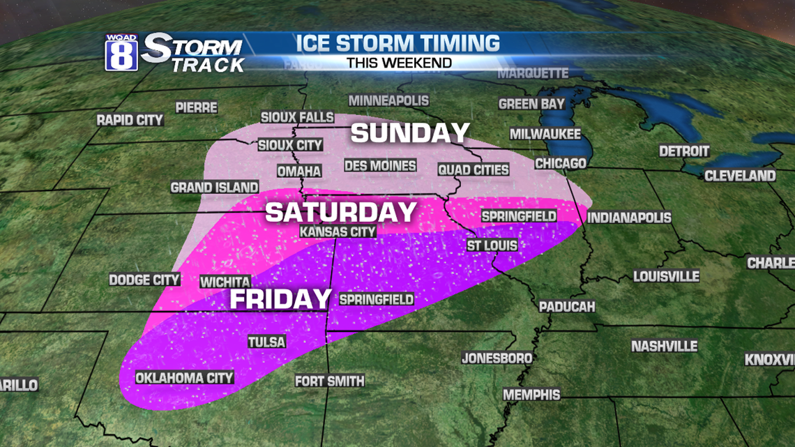
For our area, a little freezing drizzle or flurries are possible very early Saturday morning...before sunrise. Other than that, Saturday will be dry for us. Some freezing rain is possible from Kirksville, Missouri over to Bloomington-Normal, Illinois Saturday afternoon. But as the evening goes on, some of that freezing rain will move north into our area. A Winter Storm Watch is in effect for much of Eastern Iowa and Western Illinois in anticipation of the travel impacts beginning late Saturday night, lasting through noon Monday.

We will continue to follow the potential for icing for Sunday. If you have travel plans, please move those around so you're not on the roads Sunday through early Monday morning.
-Meteorologist Eric Sorensen