Got your attention, didn’t I?
We are already tracking a potential for more snowfall! But before we get into that, be sure to check out the cold temperatures. That’s what we need to get through first. Click here to see how cold it will be Thursday and Friday.
Here’s the set up for the weekend.

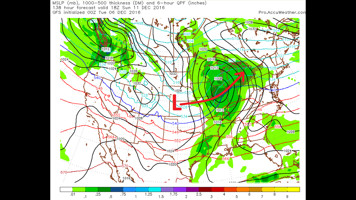
First up, some of the raw computer models. Above is the solution from the National Weather Service’s GFS computer. It shows low pressure moving from Kansas into Michigan this weekend. Developing low pressure would be able to utilize more Gulf of Mexico moisture. Notice the closed circle that says “1008.” That’s the intensity of the low pressure system in millibars. A 1008-millibar-low-pressure isn’t all that strong. Mature winter storms and blizzards are on the order of 980-995.

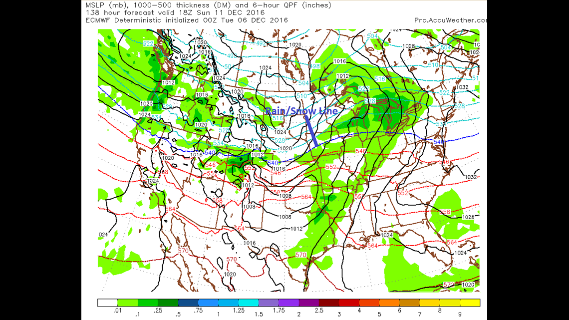
A different model not only brings in moisture, but it increases temperatures. The blue line (labeled 540) is usually where the rain/snow line is. Above the line, snow. Below the line, rain. We all know that if we get above 32 degrees in the atmosphere, rain will fall from the clouds. The above scenario has rain falling across the Quad Cities on Sunday.

-Meteorologist Eric Sorensen