
Good morning everyone!
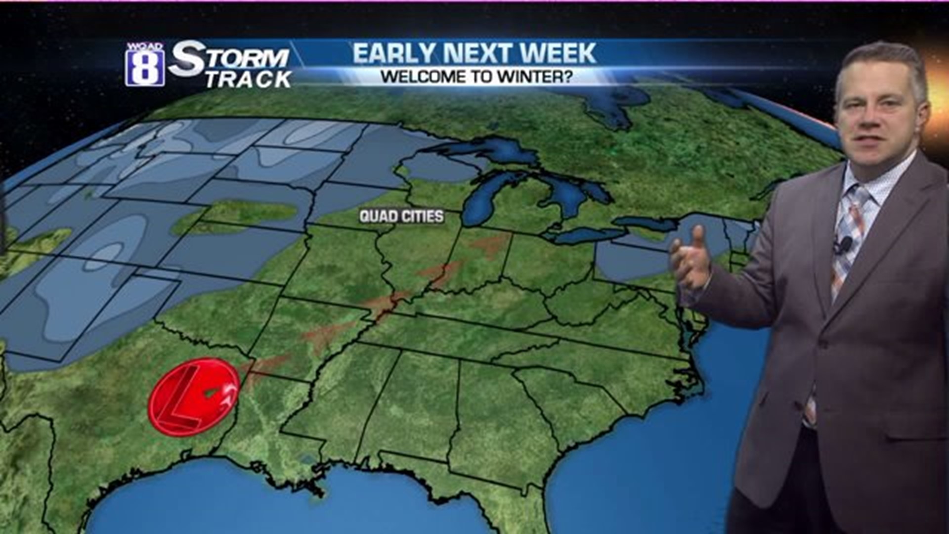
Yesterday, word quickly spread about the potential for some wintry weather next week. While it's hard to get precise with details at this point, there are little pieces of the puzzle worth looking at. And these little pieces give us clues into what to expect next week.
What we know right now is it will be very unsettled across the middle part of the country next week. That's a pretty sure bet at this point. And the majority of our weather models are placing a pretty big low pressure system in the mid-continent early in the week with one model delaying it until Thursday. Certainly, there is an influx of moisture and the cold weather will be on the move from Canada. But will it be cold enough here when the moisture arrives? That's the big question.
So what's changed from yesterday?
On Monday morning, there was only one weather model that showed a snowy system for early next week. I bit on the bait, just because the "ECMWF" model is a pretty decent model to look at when it comes to winter storms. The time frame is for Sunday/Monday of next week. But the other reliable weather model, the "GFS?" Sunshine.
Today, we're one day closer to the event so we should have more details, right? Well, sort of. At this point, instead of fine-details, we are looking for consistency in the models. Yesterday, I only had two models that went out beyond day #7, so there wasn't much information to assess. But today, we have two more.

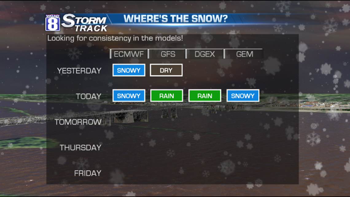
Yesterday, the ECMWF model had a snowy solution for next week. Today's model run still shows snow. Yesterday, the GFS model was completely dry. This morning, the model is now turnning unsettled, indicating the potential for rainy weather. But now that we're within a week, we have two additional models to look at. The DGEX model has a rainy solution, while the GEM model has snow.
Can we come to any more conclusions than we had available yesterday? Not really, but the chance of seeing wintry weather is still there for next week. Maybe even increasing a bit.
Stay tuned as tomorrow morning, we'll fill in the blanks on the graphic above...looking for consistency. The more we see on a day-to-day basis, the more accurate the forecast will be.
-Meteorologist Eric Sorensen