
Reality check! The Quad Cities saw snow two years ago this week. Last year at this time, we were bracing for up to 10 inches of accumulation. yes, it's that time of year (even though we may not feel ready since it's been so warm).
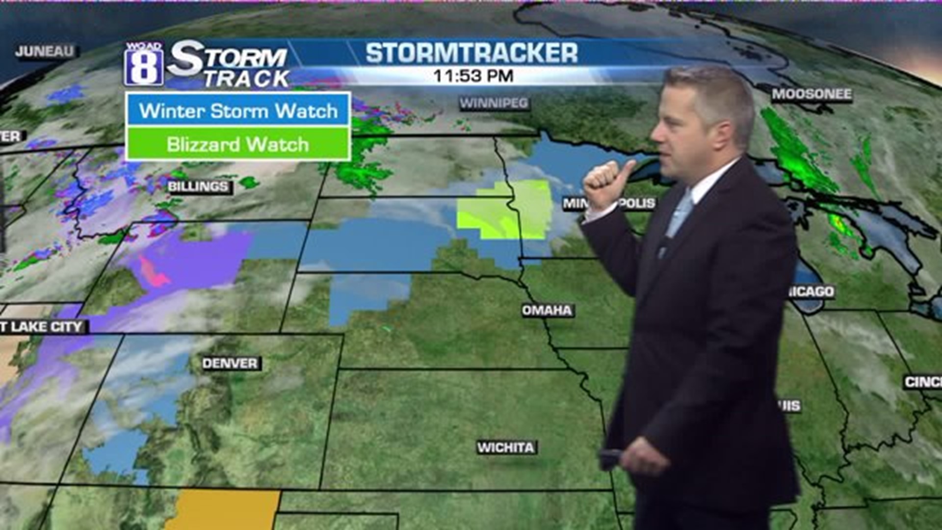
National Weather Service offices in the Upper Midwest are forecasting the first snowstorm of the season. Parts of South Dakota, North Dakota, and Minnesota are in the crosshairs where several inches of snow are expected, along with winds that could gust above 40 mph!
The epicenter for this winter storm is likely to be between Sioux Falls, South Dakota and Minot, North Dakota. The National Weather Service even warns of white-out conditions that could affect travel on Interstate 29.
For travelers on I-90, look for wintry conditions west of La Crosse, Wisconsin Friday evening. I-94 could be snow-covered, Friday night west of Eau Claire, Wisconsin. I-35, north of Mason City, Iowa.
For the Hawkeye State, not much accumulation is expected. However around Sioux City, a few inches could accumulate Friday.

