Good morning all!
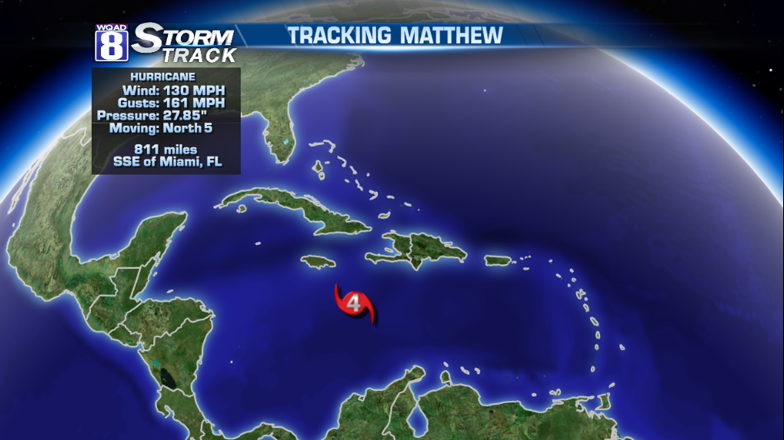
All eyes on Hurricane Matthew, a powerful category 4 storm. It’s currently in the middle of the Caribbean Sea, moving north toward the eastern shore of Cuba. In it’s path is Haiti, which could see a tremendous amount of rain and flooding, in addition to winds over 100 mph. That would be a tough blow to the poor island nation.
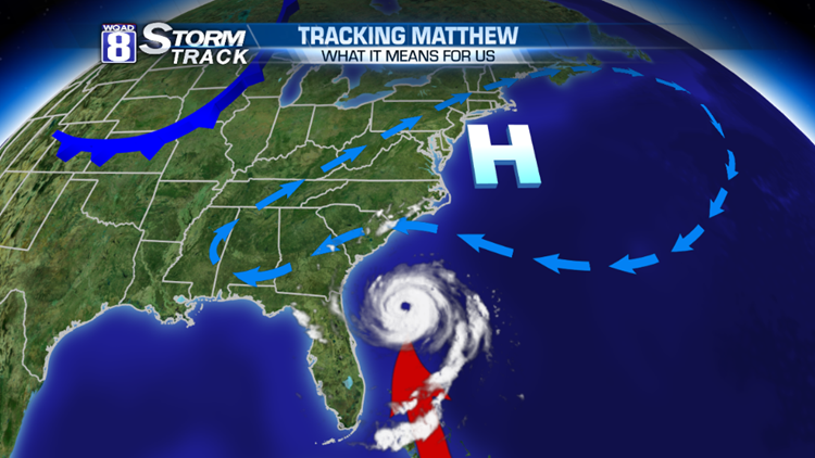
As Matthew moves north, it will veer toward Florida by midweek. After that, it could move into the Carolina Coast or head back out to sea. It will be running into a strong area of high pressure. As the hurricane pauses the movement of that high, it will also pause the movement of the cold front into the Upper Midwest.
Here’s where it gets tricky for us late this week. While we won’t have rains from Hurricane Matthew, the hurricane’s movement could stall a cold front. That would be enough to start the rain here on Wednesday, not having it leave the area until Saturday or Saturday night! If that’s the case, we could have some significant rains…on the order of a few inches even.
But this forecast is filled with “what-ifs” and because of that, we have low-confidence in that rain chance for Friday and Saturday. Slight deviations in the hurricane path will have some impact on our weather late this week.
Stay tuned!
-Meteorologist Eric Sorensen