
Even though forecasting this winter season is speculative at best, it has gotten to a point where it is possible to get solid signs of what direction this upcoming season is trending towards. We’ve already have presented a couple of those on our latest blogs which favor more cold and snow. Here’s another computer model that I found on a recent post. Lets first check out this graphic that represents whats going on in the middle of the atmosphere. This is a layer where you can not only find the gradient of equal pressure (contours lines) but where we find troughs and ridges that steer winter storms and cold. May be a bit hard to see but I’ll break it down for you.

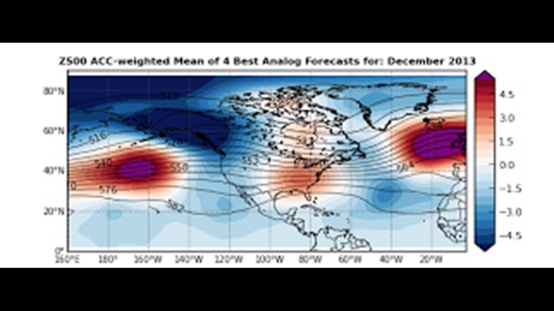
Check out the dip or trough between Hawaii and west of Mexico. This is a feature we have seen on multiple forecast models for this winter. This would most likely mean storm systems would move northeast toward the southern Rockies. From there, they will most likely either shift northeast to hit the Midwest or keep south and eventually head toward the Appalachians.
However, in the southeast portion of the country, I do see some slight ridging. This ridge would be able to push storms north and create the Panhandle Hook and/or Colorado Low storms that I mentioned in my last blog. This would also limit the possibility of storms moving into the Appalachians.
Making our way back west around the Pacific Northwest also shows some slight ridging. This is a favorable storm track for the Midwest by sending down a healthy supply of cold air.
So, the signs are there for shots of cold but the possibility for above normal snowfall for the Midwest to start off the winter season. We’ll shall see. :0)