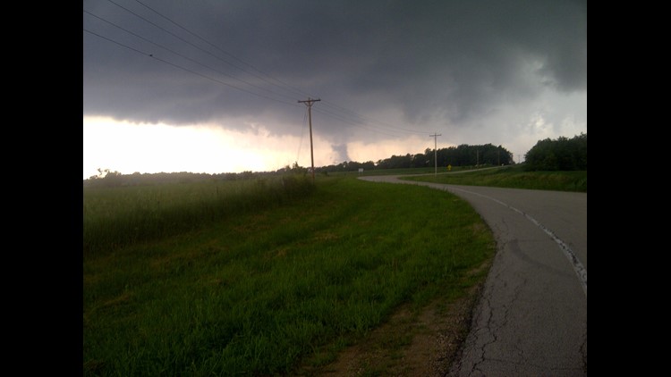
Funnel clouds were reported Wednesday afternoon, June 12, 2013 as severe thunderstorms moved through counties near the Quad Cities.
The National Weather Service issued a tornado warning for eastern Lee County just before 4 p.m. after radar indicated a possible tornado near Amboy.
The warning was allowed to expire at 4:30 p.m.
A trained spotter reported a funnel cloud at 4:06 p.m. at Route 251 and Interstate 39 at Paw Paw in Lee County, Illinois.
Law enforcement reported a funnel cloud heading northeast from Rockford, Illinois at 4:25 p.m.
A trained spotter reported quarter-inch-sized hail about five miles northeast of Paw Paw in De Kalb County just before 4:30 p.m.
A trained spotter in Wisconsin also reported seeing a funnel cloud at 5:19 p.m. about four miles east of Durango in Dubuque, Iowa.
The Dubuque County, Iowa emergency manager reported a funnel cloud was observed near Highway 151 south of Dubuque in Key West at 5:48 p.m. Between 8 and 8:30 p.m., a trained spotter reported a wind gust of 60 miles per hour east-southeast of Peosta and law enforcement reported hail 1.75 inches in diameter on the north side of Dubuque.
A trained spotter reported pea-sized hail and heavy rain in Galena at 6:12 p.m.
Law enforcement reported seeing a funnel cloud at St. Donatus in Jackson County, Iowa at 6:17 p.m.
Spotters also reported a tornado two miles south of Hanover near Highway 84 in Jo Daviess County just before 7 p.m.
Dubuque, Jackson, Jo Daviess and Carroll counties all experienced tornado warnings in the late-afternoon and early-evening hours.