A trained spotter reported a funnel cloud in the air and large heavy hail accompanied storms that moved through Henry, Bureau and Putnam counties Sunday.
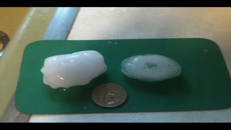
Hail between a half-inch and golf-ball size was reported near Bishop Hill, Galva, and Princeton. It was all part of storms that pushed through the area Sunday afternoon between about 1 and 3 p.m.
A trained spotter reported a funnel cloud about seven miles west of Princeton at about 2 p.m. The funnel cloud did not touch the ground and no debris field was reported.
The National Weather Service in Davenport, Iowa extended a severe thunderstorm watch for several counties in our area until 9 p.m. Sunday. The watch area was primarily along and south of a line from Mt. Carroll, Illinois west to Iowa City, Iowa.
Damaging winds and large hail, along with torrential rainfall, were possible.
Once Sunday’s storm threat passed, the NWS said “the probability for widespread hazardous weather is low” for the rest of the week.